


Tropical Storm Conditions expected by Pilar in the Southwestern Mexico
The National Hurricane Center has indicated in its 1 pm advisory that Tropical Storm Pilar is bringing heavy rains with strong winds to the areas of Southwest Mexico and warning effect for its coastal areas. The agency also said that the storm is located at an estimated 25 miles South-Southwest from Cabo Corrientes, Mexico and 85 miles South-Southeast in the Las Islas Maria of the country. NHC has indicated on Sunday afternoon that a Tropical Storm Warning was in effect for the Southwestern coast from Playa Perula to northward El Roblito, including Islas Maria in Mexico. The Mexican government also discontinued a warning from Manzanillo to Playa Perula. The maximum sustained winds of Pilar were calculated at 40 miles per hour with heavy dust clouds.
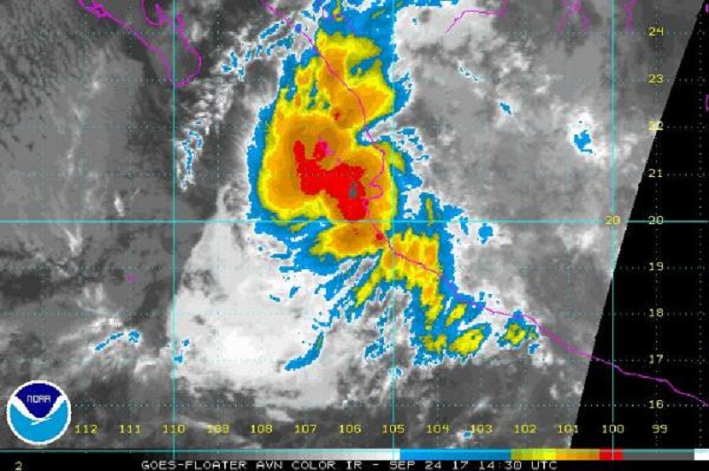
On Sunday, the storm was moving towards North-Northwest at an estimated speed of 8 miles per hour. The National Hurricane Center has forecasted that Pilar might produce about 3 to 7 inches of rain with an isolated maximum rainfall of 15 inches over some areas in the states, including Colima, Michoacan, Nayarit, Jalisco, and Southern Sinaloa through Monday afternoon. The NHC also warned that rainfall might lead to heavy floods and mud slides with possible life-threatening aptitude. The NHC further said that the conditions of Tropical storm were expected to spread gradually northward along the Mexican coast through Monday. The NHC forecaster Chris Landsea said that this new forecast is comparatively below from its previous advisory and now Pilar might become lower in the coming 2 days.