

A threatening satellite image of Hurricane Matthew was making arrival over Haiti by showing a supposed skull. The Hurricane Matthew was a headline for most news outlets on 4th October 2016. One of the satellite images was showing a storm got more public attention. Hurricane Matthew made appearance on Haiti at 7:00 a.m. local time. The storm was considered Category 4 and there were a number of scattered news, but some early and authentic reports have indicated a considerable amount of damages in the area. Most of the reports indicated that communication system has been destroyed and there is not any kind of authentic information that how many people have lost their lives and how many injured.
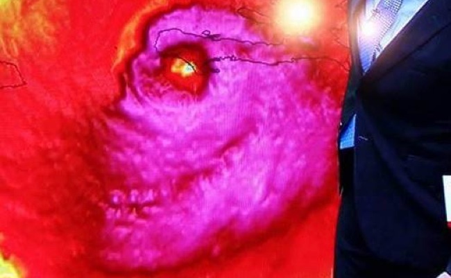

The Civil Protection Force of the country issued their initial report and indicated that two people reported dead. Most of the Satellite images were showing flooding after an expected storm with powerful winds. Point to be noted that a supposedly “Skull” image appeared during the coverage with satellite images. Matt Devitt from WINK-TV of Southern Florida discovered a Skull on the representational satellite map near his hand. This image picked by most of the social media websites with confirmation that published image was authentic and not fabricated in any way. The Satellite Skull in the map of Hurrican Matthew should not be considered the first map got popularity on social media network because most of the satellite maps represent various different objects.